Barbados for Hikes, Beaches
Thursday, September 30, 2010

Seth Kugel for The New York Times Bath Beach at sunrise.
I picked up a few money-saving tips during my four days in Barbados last week:
1) Drink tap water instead of bottled; it’s safe.

Seth Kugel for The New York Times A bus stop on the island’s eastern shore.
2) Take the bus, not a cab, from the airport to your hotel.
3) Avoid paying the cover for live music at McBride’s Pub by befriending the Brazilian women’s boxing team.
I admit, the third may not be universally applicable, but it sure saved me some bucks (15 Barbadian dollars, or $7.50 at a simple 2-1 exchange rate), so I’d be remiss in not passing it along.
Turns out that my trip coincided with the world championship of women’s boxing, also being held on the easternmost island of the Caribbean. My first night, I spotted three women wearing Brazilian athletic outfits and strolling along the island’s night-life row. I am a big fan – and part-time resident of — Brazil, so I introduced myself and invited them all for a drink.
Lest you think that either a) the Brazilian women’s boxing team boozes during tournaments or b) the Frugal Traveler can afford to buy three women a cocktail, let me clarify. First, my new friends Glauce, Clélia and Andréia had already been eliminated from their weight classes. And second, I was taking them to Café Sol, where the two-for-one, 10 p.m.-to-midnight happy hour meant a round would cost a mere 24 Barbadian dollars ($12).
So soon we were sipping mediocre, beggars-can’t-be-choosers frozen margaritas, and I was doing what any man surrounded by female Brazilian boxers must: beg for a team T-shirt. Clélia said she had an extra uniform (like the one in the photo accompanying this article), and would bring it to me the next night. She did, I put it on, and we were all waved into the dance party at McBride’s, where a mixed crowd of tourists, Barbadians and Barbadian-American tourists packed the sweaty house.
It was a nice change from my trip to slightly stuffy Bermuda. Both had perfect swaths of white sand lapped by brilliantly, pleasantly warm blue waters. But Barbados also had a vibrant, warm, slightly scruffy local scene to go with them. Add to that the incredible kindness with which this island’s residents — who call themselves Bajans — treat foreigners, and you’ve got one heck of an island.
Even its size seems perfect. Shaped like a ham (or, for vegetarians, an off-center pear), Barbados measures about 22 miles from top to bottom and at most 14 miles across – too big to get bored in, too small to get lost in.
Upscale resorts dot the western coast, and the bustling southern coast is full of budget hotels and nice – if teeming – beaches. The rest of the island is more raw, more wild. There are empty beaches; former plantation houses; historic parish churches; and small villages largely consisting of what Bajans call chattel houses, tiny old wooden homes, many of which are barely bigger than a small New York City studio apartment.
I spent a lot of time in the south, on the beach or at the Gap or eating at good places like Just Grillin’ and Ackee Tree, but I spent more on trips around the island. Buses will get you just about everywhere. Blue public buses, yellow private buses, and private vans are all 1.50 in Barbadian dollars (75 cents) per leg, no matter how far you go.

Seth Kugel for The New York Times Hiking with the Barbados National Trust.
My favorite spot by far was the sparsely populated east side, where surfers – and few others – flock. I got to see the east side’s other, er, side. I figured an easy way to do so was one of the free weekly hikes run by the Barbados National Trust that start out from a different point of the island each Sunday morning at 6 a.m. That’s how I found myself standing in the Bath Beach parking lot with about 60 or 70 Bajans on my third morning there. (I could spot only one other semi-outsider, a Bajan visiting from New York. ) The trust’s general manager, William Gollop, showed frightening good cheer as he explained that the hikes were available in five levels of difficulty. I joined the second easiest.
Make that the fourth hardest. We set off down a sometimes grassy, sometimes wooded trail that hugged the rocky coastline at a pace I associated more with speed walking than hiking. But the terrain was flat, and I kept up as we ducked under branches, swashbuckled through high grass and admired the crashing waves against rocks below.
It was when we cut inland and sharply uphill into the woods that I began to suffer. Pretty soon my heart was beating so hard that it upped the intensity of the pounding in my skull. Note to self: next time you are going hiking at 6 a.m., lay off the Mount Gay Rum on the rocks at Sweet Potatoes’ Latin night the previous evening.
The leaders of the hike felt my pain, though, and swung into be-kind-to-tourists mode. When I had to stop and catch my breath a few times, someone always waited with me, never remarking that several young children had passed me by. When I finally reached the top of the hill – after a final narrow, steep and tortuous passage between two rocks that required you to pull yourself up by vine, I was rewarded with a view of the coastline below, and a long, easy trip down.

Seth Kugel for The New York Times A view of the coastline.
The trip down, through villages and by churches, was much more sociable (in that I could breathe). I struck up a conversation with a Bajan named Roslyn Straker, who took it upon herself to become my fruit tree guide, picking fruits growing from trees everywhere – dunts, Barbados cherries, guava, even a fruit I had never heard of before, the janum. (Yes, I had heard of dunts – the day before.)

Seth Kugel for The New York Times Near Bathsheba Beach.
After we finished the hike – at barely 9 a.m. — I downed two snow cones (1.50 Barbadian from a woman who drives her snow cone truck to meet the hikers’ finish every week), and Mr. Gollop was kind enough to give me a ride to Bathsheba, the main town on the east side of the island.
I headed straight for the beach, where a swim and a nap were in order. The surf was fierce, in some spots crashing just offshore into dramatic rock formations carved by waves over the millennia. But there were other places to take a dip, and a handful of Bajans were taking advantage as I dozed.
 Seth Kugel for The New York Times The view from the Round House Inn, in Bathsheba.
Everyone I met in Bathsheba recommended that I eat lunch at the Round House Inn up the hill above the beach. I landed a choice table with a view of the water and ordered pork chops in Bajan barbecue sauce, macaroni pie, salad and a spiked rum punch. Cost? Fifty-six Barbadian dollars, which I justified under the you-deserve-it-after-a-tortuous-hike clause of the Frugal Traveler unwritten contract. I ended the day with a walk (uphill, argh) to the Andromeda Botanic Gardens: nice, but no better than the free fruit-tree-tour I had gotten that morning from Roslyn.
One other worthwhile daytrip was to Speightstown, a slow-going historic port town on the northwest coast with little to do but walk around and enjoy the atmosphere – including a drink at a traditional Bajan rum house called Val’s Hideaway, housed in a chattel house on Mango Lane. I wish I could say there was some great chattel house hostel I stayed in for $10 a night through all this, but such a place does not exist. There are two other budget options, however, at slightly different definitions of “budget option.” The Intimate Hotels of Barbados site offers loads of hotels for under $100 a night, one of which was the Pirate’s Inn. The price listed on the Web site is 167.44 Barbadian dollars ($83.72) plus taxes, but when I called to reserve by phone and asked for their cheapest possible price, they offered me the Caricom rate (given to Caribbean residents), a discount of about 10 percent.

Seth Kugel for The New York Times Marlin at Oistins Friday night fish-fry.
But two days in, I moved to a guesthouse recommended by fellow bearers of the JetBlue All-You-Can-Jet pass, Saska and Paul, whom I met on the bus to the famous Oistins Friday night fish-fry. Over immense plates of marlin, macaroni pie and salad (17 Barbadian dollars, or $8.50) from one of the endless stands serving huge crowds of Bajans and tourists, they shared their find: a guesthouse called Cleverdale, where they were staying for $32 for in double room. I moved in the next day, even though the owner chose to charge me $40.
Cleverdale was far from luxurious – it had no air-conditioning and a shared kitchen, for example – but it was perfectly clean and friendly and had a beach view. It was also a 30-second walk away from the object that view, Worthing Beach, a pretty white stretch of sand popular with local families on weekends. Forming a cluster with Cleverdale were two other guest houses that travelers staying there suggested might even be better: Rydal Waters Apartments, and Maraval Guest House.
All also had the advantage of being within short walking distance of the St. Lawrence Gap, saving late-night money on cabs home and increasing the odds, however slight, of bumping into the Brazilian women’s boxing team.
From http://frugaltraveler.blogs.nytimes.com/2010/09/28/barbados-for-hikes-beaches-and-a-brazilian-boxers-t-shirt/
Labels: Barbados, Barbados National Trust, Bath Beach, Bathsheba, chattal house, East Coast, macaroni pie, McBride's, Mount Gay, Oistens, plantations, rum, St. Lawrence Gap, surf, Worthing
Beautiful Barbados Beaches
Tuesday, December 22, 2009
Although we have only been to Barbados in the summer, it has an appeal throughout the year. The Caribbean is known for hurricanes but it is very rare for one to hit Barbados.
Barbados is a relatively flat coral island with an abundant supply of large gradually sloping beaches.
All beaches on the island of Barbados are considered "public", although some are harder to get to than others!
Over 79 miles of beautiful white and pink sand beaches await you on the island of Barbados – come on in, the water’s great!
Crane Beach 


 My personal favorite, of course, is the Crane Beach.
Set on 40 acres of oceanfront land in the parish of St. Philip on the Southeast Coast of Barbados, The Crane is the island's oldest vacation resort. Conveniently located just six minutes east of Grantley Adams International Airport, the resort boasts a spectacular natural setting on a cliff overlooking the renowned Crane Beach. The Crane was recently awarded a Four Diamond rating from the Automobile Association of America (AAA). Today, The Crane is comprised of the original historic hotel building, built in the late 1700's and expanded in 1887, and a new all-suite development. Seven of ten phases of The Crane's new development are complete. On completion of the development, this world-class report will also feature a Bajan village offering retail shops, bar 1812, art gallery and museum; a full-service spa set in a coconut grove on the beach, a choice of gourmet and casual restaurants and flood-lit tennis courts. www.thecrane.com
Originally a harbor, Crane Beach is located at the famous Crane Hotel, and has been voted one of the ten best beaches in the world by "Lifestyles of the Rich and Famous". Bigger waves make it good for body surfing, but in the cove to the left there is safe swimming close to shore.
You will have to walk down to the beach or take the new elevator down the cliff. There is a charge for parking, waived if you have lunch at one of the restaurants.
Nearby, about half a mile to the south is Foul Bay. Despite it’s name (it just meant that it was hard for ships to make harbor) this is a spectacular beach that is usually quiet. There are no facilities, so it is best to take your own food and drink. A great place for a day picnic.
Bottom Bay
 Just north of the famed Sam Lord’s Castle, this bay is surrounded by high coral cliffs, and is the perfect beach postcard with lots of coconut trees, crystal turquoise water, and a large expansive beach area. It has medium waves, slight undertow, and a favorite picnic spot with Bajans and visitors.
Take your own food and drink as facilities are not nearby. A very popular beach for surfers but beach lovers will find lots of secluded spots.
 Sam Lord's Castle is closed now but has been bought by another hotel company and should reopen...sometime.
Sam Lord was a pirate way back but not the kind that went to sea. He stayed at home, in his castle (pictured left), and put lights on the coconut trees so ships would think that they were near Bridgetown. They came close, crashed on the cliffs and Sam added to his treasure.
Church Point 

A very special beach, clean, not very wide and somewhat sheltered, the waters are almost always placid with no undertow and good snorkeling. This beach is in front of the stunning coral stone Heron Bay House, which is almost as beautiful to view as the pristine beach it looks upon.
Heron Bay has hosted many famous guests, including former US President Bill Clinton, former British Prime Minister Sir Winston Churchill, and several movie stars. The house was built in 1947 by the late Ronald Tree, a member of the Winston Churchill British Cabinet.
The house is set on 20 acres of manicured gardens, including a small lake, and the property is often opened as part of the Barbados National Trust's annual Open House Programme.
Long Beach 
Long Beach stretches for more than a mile and is very flat and narrow, a great find since it is secluded and private. The nearby long Beach Club has facilities here but this is a fairly private setting.
Long Beach is situated in a natural environment. The buildings that are visible from the beach are a blend of period and modern properties and very attractive. The natural beach environment consists of rocks and cliff faces and is stunningly beautiful.
The sand is very fine and has a bright, white color and the beach and water are very clean. The seawater is a beautiful shade of light blue and is crystal clear.
The beach can only be reached by climbing a trail / by walking downhill. However, parking is available near the beach.
Dover Beach
 Lying at the Southern end of the St. Lawrence Gap ’strip’ this is a popular beach among visitors to the south coast. Medium waves and a number of facilities close by add to its appeal.
This is charter-holiday territory, where families mingle on the sands with a procession of brides and grooms searching for that ultimate Caribbean wedding photo.
Cattlewash

 This by far the longest beach on the island. It’s rough and rugged splendor make it a popular sightseeing and relaxing spot. It is several miles long and very often deserted. It is a perfect location for nature lovers.
This beach is a little north of Bathsheba and is a frequent “sight” on sight seeing tours. Its name defines it’s original function.
This area is a very popular get-away spot for Bajans, especially during the summer months. Although it is a very scenic and relaxing area, there are strong currents in the area and swimming in open water is not recommended. There are however many pools, surrounded by rocks where one can bathe safely.
Bath  There is usually a lifeguard and there are parking, changing, picnic and eating facilities. Medium to small waves and slight undertow close to shore make this a good swimming beach.
Bath Beach is the perfect swimming beach, and there are plenty of shady trees to relax under with a picnic lunch. There are no restaurants here, but changing rooms are provided.
Mullins Bay
 This is another popular hangout, a picturesque bay with a nice, placid beach almost all year round. Plenty of facilities, from parking and eating, Mullins are also a very good snorkeling area. Located in a cove, the water is always calm, and crystal clear.
You'll find plenty of places to eat, especially Mullins Beach Bar, and parking is provided across the street. Beach chairs are available for rent.
Folkstone Beach
 There are many water-related activities, along with fresh water showers and shops. There is an interpretive centre and museum. The underwater park zone extends from Sandy Lane to Colony Club and you can rent snorkeling equipment around the fringe reef, or hire a boat for diving.
Sandy Lane Bay
 The beach of Sandy Lane, the island’s most opulent resort is home to Villas on the beach, Barbados. This is a long, wide beach which is in pristine condition and well-maintained. Quite literally it can be a VIP spotting beach with many a celebrity holidaying here.
Labels: Barbados National Trust, Bath Beach, Bathsheba, Bottom Bay, Cattlewash, Church Point, Dover Beach, Folkestone Marine Park, Foul Bay, Long Beach, Mullins Bay, Sam Lord's Castle, Sandy Lane, snorkel, The Crane
Morgan Lewis Mill Barbados
Friday, October 16, 2009
Morgan Lewis Mill is located on the top of a beautiful hill in the north eastern part of the island of Barbados. It is one of the two restored sugar mills in the entire Caribbean. The mill commands an excellent view of the amazing east coast. The mill is located near the Wildlife Reserve and Bathsheba. The Morgan Lewis Mill serves as a refreshment halt where ice creams and cool drinks are available. The mill which is maintained by the Barbados National Trust exhibits the equipment used to produce sugar when mills were run by wind-generated mills.
Morgan Lewis Mill, which has undergone a lot of restoration work undertaken by the Barbados National Trust, is one of the oldest mills in this area. This large mill which functioned during the 17th to 19th centuries and produced sugar for Barbados was famous throughout the world and is still intact. Photographs of the mills during it’s hey days can be seen within the mill. The mill has been declared as a UNESCO World Heritage Site.

In the yesteryears, Barbados was famous for its sugarcane cultivation and there were a number of windmill operated sugarcane crushing units. The immense number of sugar mills put Barbados on the world map and it was one of the prominent producers and exporters of sugar. This mill is called a Dutch-style mill and these types of mills replaced the older and less efficient cattle-powered mills. The Morgan Lewis Mill had the capacity to extract 65% of the sugar found in the sugar cane. The yokes and ladles and other implements for sugar extraction can be seen at the mill.
This mill which was constructed in the year 1727 continued to function and produced sugar till 1945. It was then donated to the Barbados National Trust in the year 1962. The trust undertook restoration work which commenced in 1964, but the restoration could not be done in totality. Restoration of the mill was taken up again in 1974, but it was not successful and deteriorated again. It was then listed as one of the world’s most endangered heritage sites. The United Kingdom undertook a 2-year restoration program and could bring back the Morgan Lewis Mill to its original splendor. Visitors who visit the mill have to pay a nominal entrance fee and where they can still see the roundhouse, tail tree, and points.
Do you know that this is the only fully intact sugarcane grinding windmill remaining on Barbados? You can see ruins of hundreds of sugar mills throughout the island. Would you like to know how the mill functioned in those days? You should then visit the island between the periods from February to April. The mill operates one Sunday a month during this period. In 1996, the Morgan Lewis Mill was listed as one of the world’s 100 most endangered historic sites.
Every visitor to Barbados should definitely undertake a trip to the Morgan Lewis Mill which provides visitors with an excellent opportunity to know and learn about Barbados’ heritage and the history of sugar production.
From http://www.world-travel-deals.co.uk/caribbean/barbados/barbados-attractions/morgan-lewis-mill.html
Labels: Barbados, Barbados National Trust, Bathsheba, Morgan Lewis, sugar
Day hike offers new perspective on Barbados
Monday, April 20, 2009
From http://timestranscript.canadaeast.com/travelleisure/article/638162
By Jill Wilson
THE CANADIAN PRESS
ROCKLEY BEACH, Barbados - I have been to the stunning north coast, watched the awe-inspiring Atlantic crash and foam on the steep cliffs and been through the animal flower caves.
The Canadian Press
Rockley Beach is one of the jewels of Barbados.
I have frequented the wild and beautiful east coast -- walked on the white sand of the chi-chi Crane beach where Hugh Grant's been known to frolic, had my bathing suit filled with sand as the powerful waves of Bottom Bay dashed me to the ocean floor, wandered around the huge, eerie coral formations of Bathsheba, which look as if a giant deposited them randomly around the shore.
I have visited the west coast, where the turquoise water is so blue that the word "turquoise" seems inadequate and where every beach is a postcard waiting to happen.
I have been to the legendary Friday-night fish fry in Oistins on the south coast, where it seems as if the whole island gathers to eat fresh flying fish or dolphin (mahi-mahi) and macaroni pie, drink Banks beer from sweating bottles that are warm before you finish them and dance the night away to reggae music.
I've been to the Barbados Jazz Festival on Farley Hill, a natural amphitheatre complete with crumbling ruins at the bottom and a panoramic view of the island at the top.
I've seen sharks and barracudas and fed a stingray at Ocean Park aquarium; I've seen green monkeys and haita congas and been attacked by a goose-like creature with a pink horrible beak at the Barbados Animal Reserve.
I've taken the awesome Adventureland 4x4 tour and bumped and banged around the backroads and byways of the island; I've visited the Mount Gay refinery, home of the oldest rum in the world.
In short, I have explored Barbados from top to bottom, so perhaps I can be forgiven, on this latest trip, for doing almost nothing at all.
My friends and I decided that our only desire this time around was to sit and watch the waves at Rockley Beach, our favourite of Barbados' many lovely strips of sand. On calm days, it's perfect for snorkelling, with a well-marked coral reef within easy swimming distance (and lifeguards on duty). On windy days, the surf kicks up enough to allow for some decent boogie boarding or body surfing.
The one concession we made to our plan of lying motionless on deck chairs and frying ourselves to a melanoma-be-damned crisp was to go on a three-hour hike at 6 a.m. on a Sunday morning, which turned out to be a significant concession.
These free weekly National Trust hikes set off from a different starting point each week; the goal is to cover most of the island in the course of a year. There are morning and evening hikes, but the 6 a.m. start time allows for at least an hour of cooler weather before the sun begins to beat down.
When we arrived at the marshalling area, we were surprised at the number and variety of people -- it's clearly a regular gathering for local hikers.
There were four levels to choose from: The Stop and Stare, which covers eight to 9.5 kilometres in the three hours; the Slow Medium, which covers 13 to 16 kilometres; the slightly more ambitious Fast Medium and the clearly suicidal Grin and Bear, which leads you on a 19-kilometre trot.
We chose the Slow Medium and set off, getting farther away from main roads and into areas we'd never seen before, from open fields to gated mansions. I'd suggest, however, that "Slow Medium" might be a misnomer. This is not a walk for dawdlers or lollygaggers; it is not a ramble. It is for serious walkers. It is, in a word, brisk.
Luckily, Christ Church is not the hilliest parish, but the walk did take us through sugar cane fields where a machete might not have been out of place and where you had to keep an eye on the ground or risk a turned ankle.
It was fantastic, giving a whole new view to the island that we never could have seen, even touring in a car. Unfortunately, I have no pictures of the scenic vistas because if you so much as stopped to tie a shoelace, the rest of the group would be a dot in the distance by the time you stood up.
After the hike was over and we'd bandaged our blisters, as one of my travelling companions put it, "Now the only thing we have to worry about is where and when we're going to eat."
But for three dedicated food lovers, that's a considerable worry. Luckily, one of our dinners was already arranged, as I'd made the reservations months prior.
Tell anyone who's familiar with either Barbados or fine dining that you're going to The Cliff and his eyes will widen gratifyingly. The restaurant -- thanks to chef Paul Owens -- has the highest Zagat rating on the island, with prices to match: BBD$245 (C$151) for a two-course prix fixe menu (not including cocktails, wine or dessert, all of which we indulged in).
In these tough times, it seems ridiculously indulgent to spend such a princely sum on dinner, but what we got was fit for a king (or at least a prince -- Prince Andrew has been known to dine at The Cliff) and how often do you get to visit a restaurant with the reputation as one of the best in the world?
Lit by flickering torches, the restaurant sits perched on a cliff, with wide stone steps that lead down to intimate tables overlooking the surf that rolls into the scenic bay below.
And the food is truly incredible: beef carpaccio that melts in the mouth; gnocchi as fluffy as pillows; perfectly cooked tender duck breast; ravishing lobster ravioli; a lemon tart that might be the best dessert I've ever had.
It was a once-in-a-lifetime experience that we'll remember forever. And be paying off for several months.
On the other end of the spectrum -- but no less enjoyable -- is It's All Good, a modest shack on Rockley Beach manned by the ever-smiling Jasmine Brown, who whips up healthful smoothies with juice and vitamin supplements. What keeps us coming back, though, is what might be the best daiquiri on the island, made with fresh bananas and a generous helping of dark island rum. For BBD$12 (C$7.50), you get an overflowing plastic cup, which Brown will often top up with whatever's left in her blender.
She also slaves over a hot barbecue to grill flying fish, marlin, swordfish, garlic shrimp and other seafood, which she serves on a plate heaped with seasoned grilled potatoes, plantain and a crunchy-sweet coleslaw-like salad topped with walnuts and raisins. It's not elegant, but it's delicious.
Another high-end highlight was Pisces in the St. Lawrence Gap, where the rum sour was perfectly mixed, the Asian-style scallops with crispy lentils perfectly seared and the atmosphere -- terra cotta lanterns, a sea breeze and a view of fishing boats bobbing in the ocean -- perfectly lovely.
Our other splurge, one we've never gone without, is a day trip on a catamaran. A five-hour cruise on a Tiami ship is BBD$175 (C$108), and more relaxing than a day of being pampered at a spa. They pick you up at your hotel and you're greeted at the harbour with a mimosa, after which you set out along the island's west coast, skimming over unreal waters that shift from indigo to azure and sipping the beverages that are brought to you from the open bar by the attentive staff, who strike the perfect balance between funny flirtiness and serious sailoring.
Along the way, you stop to snorkel and swim with sea turtles, which, no matter how many times you do it, is a wondrous experience. The turtles, with their wise-looking faces and mottled shells, are not shy and will brush up against you in the water.
After a lavish buffet lunch, the boat anchors off the luxurious Sandy Lane resort, where you're free to swim ashore to the beach or just lie back and bob effortlessly in the buoyant blue.
God forbid we should exert ourselves.
Labels: Adventureland Safari, Atlantic, Barbados, Barbados National Trust, Barbados Wildlife Reserve, Christ Church, flying fish, Hike Barbados, Ocean Park, Oistens, Rockley, rum, Sandy Lane, sea, snorkel, St. Lawrence Gap, Tiami
Measured by the foot
Saturday, October 18, 2008
Pure air, pristine beaches, and miles of byways make hiking eye-opening
By Patricia Borns
Globe Correspondent / October 19, 2008
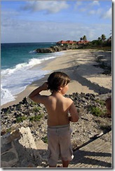 Belair is where Barbados's tourist industry got its start. Codrington College in St. John Parish opened in 1745 and is the oldest Anglican theological school in the hemisphere. (Patricia Born for The Boston Globe)
The young British fencing coach had left her friends on the beach to go hiking. It was her first time in the Caribbean.
"Hot weather doesn't normally agree with me," she said, nor, she admitted, had hiking. "At home it's an older person's sport."
We met in the East Coast village of Bathsheba, where some 50 outdoors lovers had materialized like a scene from "Field of Dreams." We hiked for four hours, fumbling through light woods and lianas (woody tropical vines); crowding reverently into a former slave chapel smothered in bush; laboring up Melvin Hill to a fisheye-lens view of the green Chimborazo valley below; and over coral promontories where Atlantic waves exploded in furies of spray.
Our guides, George Medford and Carl Fenty, reminded us that the wind washing over us travels some 2,600 miles across the ocean to this coast from The Gambia in West Africa and is some of the purest air in the world.
"This track was part of the Barbados Railway built to transport sugar cane and tourists," said Fenty. "It went bust five times before ceasing operation under its last owner, the Society for the Propagation of the Gospel in Foreign Parts. A first-class seat with champagne cost 48 cents; when the train stalled, the third class got out and pushed."
As we spilled down a heathered slope to the seascape of Cattlewash, raw and romantic in the Byronic sense, the fencer turned to me with shining eyes. "I'm definitely coming back here," she said.
While Barbados can be enjoyed without ever leaving West Coast Highway 1, which is fringed with beaches and hotels, a local passion for walking has created opportunities to explore more than 800 miles of roads at little or no cost. Our trek was one of 45 rambles offered free by Hike Barbados, a program of the Barbados National Trust. No reservations are necessary: Simply meet Sunday morning or afternoon at the designated location, break into groups according to pace, and experience a 6-to-14-mile slice of the island that you might not otherwise see.
"Everything we encounter has a reason in history. Our early settlers planted those palms around their plantations so insect-eating birds could nest in safety," said Victor Cooke, a professional guide and National Trust volunteer, on a hike in rural St. Lucy Parish. "Those mahogany trees were planted near the driveway to shade workers waiting to begin the day. You always see these peas planted at the edges of fields. They were used to make jug-jug, a Christmas stew."
It seemed to my fiance, Ron, and me, that at least half of our company were Bajans (or Barbadians), not visitors like us. Richard Goddard, a program founder, explained, "Hike Barbados started not as a tourist attraction but as a way to connect our own people with their environment and heritage."
We noticed several hikers wearing T-shirts inscribed "the Colin Hudson Hike," commemorating a Hike Barbados leader who died a national hero for his advocacy of sustainable development.
If the turnout for the St. Lucy hike was a good indicator, more Bajans than ever are hitting the trails. When we passed through villages (and increasingly, subdivisions), children and grandparents greeted us with a "Good morning" or "All right," as if the sight of 60 backpackers strung out in twos and threes was an everyday occurrence.
Hiking changed our vacation from the lazy idyll we had planned. We began buying rock cakes of dense Bajan coconut bread for carb fuel and saving empty water bottles to fill at the ubiquitous roadside stand pipes, the island's first water supply fed by underground springs. Our pockets bulged with chips of 18th-century blue and white porcelain, clay pipe stems, and wisps of Sea Island cotton. The best prize, an Amerindian adze made of conch shell, was found and given to us by a local insurance agent who placed its age at 500 to 1,000 years.
Members of smaller groups invited us to join their hikes. One, a Wednesday trek in St. John Parish, climbed to soaring views of Consett Bay and Ragged Point; crossed the gold-grained sand of Bath beach; slogged up Society Hill; and lingered beside the lily pond at Codrington College, where young West Indians study theology in the hush of majestic coral stone buildings.
An ambassador's wife told us about BH3, the Barbados Hash House Harriers, part of an international network whose free outings are modeled on the English schoolboy game Hares and Hounds. The group meets at locations across the island every Saturday at 4 p.m. and welcomes walkers as well as runners.
We tried them all.
Who would have guessed that a 21-by-14-mile island could seem so large and varied? The meandering quality of the roads contributes to a perennial sense of discovery - and to the frequent experience of getting lost.
"Every road in Barbados leads to your destination - eventually," Thomas Loftfield, an assistant director at the Barbados Museum, said reassuringly. The museum's collection of early maps clarifies why this is so. By 1645, English settlers had almost completely deforested Barbados and replanted it with sugarcane, which would drive the economy for the next 350 years. Today's roads and public rights of way are a web of those 17th-century cart paths and cane field intervals.
If there is a successor to Colin Hudson as the articulator of Barbadian byways, Adrian Loveridge might be it. "It's almost painful to reveal the spectacular beaches encountered on this hike," said Loveridge as we picked our way along five miles of the East Coast from Bottom Bay to Crane Beach in St. Philip Parish. Together with his wife, Margaret, Loveridge has packaged six hikes with a stay at the couple's hotel Peach and Quiet, in Christ Church Parish, located near one of Barbados's best unpublicized beaches.
We were seeing the others now: Ginger Bay, Harry Smith Beach, Sam Lord's Beach, and Belair. From a tourist map, you might never know they existed or were accessible by car or bus.
"Barbados was born when the original [tectonic] plate fragmented and the Caribbean portion slid beneath the Atlantic one," Loveridge said as we wound among fossilized crags. "Corals thrived in the shallow water this created, and with a final tectonic push, up came our coral-capped island - you're walking on the ancient, submerged plate now."
A staircased ruin appeared weirdly at the shore's edge. "Three guesses as to what this is," Loveridge challenged us.
"The remains of a health spa," he said. "Picture ladies in Victorian bathing costumes being carried to the beach in litters hoisted by Bajan men."
Invariably the hikes ended with some of us removing to a restaurant or rum shop, where we didn't hesitate to try a full-sugar-strength Plus or caloric staple like macaroni and cheese pie. Moving slowly and poetically through beautiful scenery is one of the pleasures of a walking vacation, but guiltless enjoyment of food shouldn't be overlooked.
We ate our hearts out and returned home tanned and toned, having lost a total of six pounds.
Patricia Borns can be reached at patriciaborns@comcast.net.![]()
Labels: Barbados, Barbados National Trust, Bathsheba, Caribbean, Cattlewash, Christ Church, Codrington College, Hike Barbados, Sam Lord's Castle, St. Lucy, sugar, The Crane
Monday, week two: Island Safari
Tuesday, September 2, 2008
Whether it was the pounding rain or the nagging reminder that I hadn't yet written the post about the races, I woke up very early this morning. I guess the rain was a part of one of the hurricanes that are out at sea somewhere - Hanna or Ike. Gustav had already been past Cuba and headed towards New Orleans. Maybe it was just rain.
Anyway, I woke up early and wrote my last blog entry. When I went online to upload it, I found that my hacked site and my 2 sites with the error messages were back up thanks to the hosting company. WooHoo! That takes a lot off my mind.
Today is Island Safari day. Island Safari is one of two 4x4 jeep Land Rover companies that takes people on off-road tours of the island. The other company is Adventureland. As we later found out, Island Safari bought out Adventureland recently, anyway!
My (Our?) favorite is the Island Safari because I like the places it goes better. The IS goes to more coastal places while Adventureland seems to go for inland places. In the past on Adventureland we have gone to Chalky Mount into a potter's studio (stuff was for sale, of course), Welchman Gully (rain forest), St. John's Parish Church (a nice, old, parish church on a cliff but too many souvenir hawkers in the parking lot), Mt. Hillaby (the highest point on the island), Hackleton's Cliff (Hackleton wanted to commit suicide so he and his horse went off this cliff. It is not known if the horse had wanted to commit suicide), and Bathsheba for lunch.
Ian, our driver, picked us up at 7:50AM. Although the "official" trip hadn't started yet, he gave us a running commentary of everything we were seeing on the say to pick up people from two other locations. 5 of the other people were other "O'Connors" from Wales. So, the O'Connors had the non-O'Connors outnumbered 7 to 4.
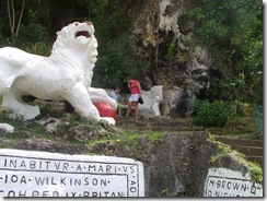 Ian told us all about chattal houses, various types of plants and much more as we headed to our convoy meeting place, the lion at Gun Hill Signal Station. This signal station was restored by the Barbados National Trust and has military memorabilia and great views. The lion was carved out of a single piece of rock in 1868 by a British Army Officer serving on Barbados. The lion has a large globe under it's paw, signifying England's world domination.
The others in the convoy were there already and had seen the lion and were just waiting for us. We had to exchange vehicles (Scooby-Doo for Garfield) because the Scooby was too low on gas. After getting our new vehicle, we took off to join the others.
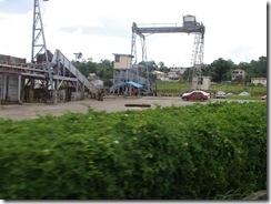 Through the sugar cane fields, past crops of yams and eddoes, past the still-working Andrews Sugar Factory, through mud and ruts, the Land Rover took us all over. Sugar used to be a very important crop here and it was used in another important crop - rum. Now the main industry here is tourism but you can still see lots of sugar growing around the island. It's a rotational crop and they rotate that with the eddoes, yams, pumpkins, cassavas, peanuts and other ground crops.
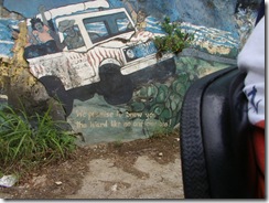 We went past an interesting cliff that has been painted on over the years. Part of the outcroppings suggest a lion, so a lion was painted there and other areas features highlights of Barbados. Here's a painting of our jeep and it's headed towards Bathsheba according to the caption.
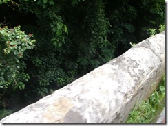 This section of a bridge is over a gully - a collapsed portion of an old cave. When this would happen, rainwater would leak in or be funneled in from the streets and birds would drop seeds in making a new forest or rain forest.
This bridge is particularly interesting. When they made it a couple centuries ago they ran out of building materials so they used what they had on hand - molasses, eggs and eggshells. And it still holds up to this day amazingly well.
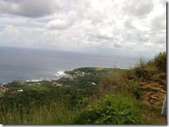 Our next stop was on a high cliff overlooking Bath. It's hard to tell from this picture how high the cliff was but we had several warnings not to get to close to the edge - No Way!
I suspect that this cliff is part of the cliff that Hackleton and his horse leaped off.
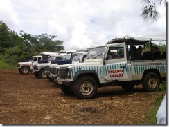 Here are all the Land Rovers lined up ready for our next adventure. They all have the names of cartoon characters and the jungle stripes are different colors.
The sides are plastic and roll down in case of rain, as we'll have a chance to discover a little later. This reminds me of "The Surry With The Fringe On Top" from the musical, Oklahoma:
"...and isinglass windows that'll roll right down, in case there's a change in the weather..."
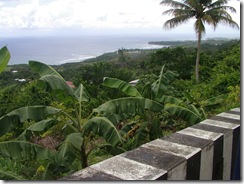 Looking over the banana trees into Bathsheba. This was taken from a solid - I hope! - bridge. To the right is one of many types of palms found on Barbados.
There are also several types of bananas, including plantains. The smaller, green ones are called "fig" bananas and they're cooked green and mashed up and used for their large iron content with pregnant women or people with anemia.
Banana plants are often used here to help prevent soil erosion. Also used to help prevent erosion are gabions. These are rectangular wire baskets filled with small rocks and strategically placed so that water can flow through easily but the soil is held behind. These gabions can often be seen near bridges.
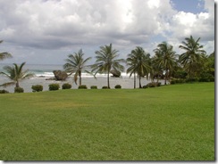 Bathsheba and one of its curiously eroded rocks in the ocean. These are being eroded away from underneath as the tides come and go.
Bathsheba is a beautiful little seaside town. Although it is too rough here to swim here on the Atlantic side, surfers practice and hold competitions here. This surf area is also known as the "Soup Bowl".
Also here is Andromeda Gardens. Although on this trip we didn't stop here, we've been there before. The Gardens were founded over 50 years ago by horticulturist Iris (great name for a horticulturist!) Bannochie. There are 650 plant species there from all over. It's an absolutely beautiful, peaceful 6.5 acres of plant heaven. There are naturally-growing orchids, palms, flowering trees, lily ponds...and animals such as green monkeys, birds, lizards and fish. It's a fantastic way to spend an afternoon.
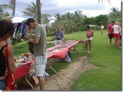 Bathsheba is also a place to pick up lovely beaded jewelry and island crafts. Here Tom is looking for a new band to replace the last one he got here.
The last time I got one was the year that Sue was with us. We all three had them and when mine finally broke Tom fixed it a few times. The last time mine broke and became unfixable I decided not to get any more, at least not for awhile. For me, the bracelet was a reminder of Sue (like Cocomos, in an earlier post) and when that broke, it was like a little part of Sue's memory leaving me.
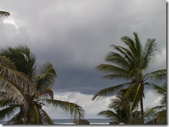 And here come the rain! We didn't roll down the curtains, at least for a while. The rain felt good and cool on my face while riding along.
When we finally put the plastic curtains down they didn't help all that much - rain dripped off the corner of mine and into my molded plastic seat making my human seat soaking wet.
We stopped taking pictures because we didn't want to get the camera wet but we probably have some from a previous year that I can insert into here when we get home.
From Bathsheba we headed north on the Ermy Bourne Highway past Cattlewash (where they used to, well, wash cattle) Most cattle on the island is for dairy only. Most people here eat chicken or fish.
After that, past Barclay Park, a popular area for locals to take a picnic or relax for an afternoon. There used to be a railroad coming up to this point but it stopped service in the 1930's.
Further along was the side of the cliff that they call the Sleeping Giant. When looked at it from the right angle, I could see how it got its name.
At some point, we went through Joe's River Forest. This Tropical Rain Forest consists of 85 acres of woodlands situated in the parish of St. Joseph. With the imposing Hackleton's Cliff on one side and the picturesque Atlantic Ocean on the other, this site is a nature-lover's paradise!
Here we saw fiscus, white woods, cabbage palms, mahogany trees (used for high-end furniture and boats, and the bearded fig trees for which Barbados was named by the Portuguese. We also saw massive termite nests on some of the trees.
We went past the Morgan Lewis Mill, the last complete windmill on the island. Originally there were 530 windmills, used in sugar production but the others have all fallen into disrepair due to changes in the sugar refining process. The Morgan Lewis is kept in good running order now as a historical landmark and it's operated on certain occasions and for school tours.
Then up to Pico Teneriffe. From this point, the next point of land is Teneriffe in the Canary Islands. This is a very interesting part of a cliffy-beach with waves coming up through breaks in the rock as huge water spouts.
The rain let us and we could roll the curtains back up, thank goodness! Without the breeze, it was getting kind of muggy. But the good stuff was finished. We headed across the island to Six Men's Bay, down past the ritzy condos of Port St. Charles, through Speightstown, past Mullen's Bay, and into Holetown for lunch.
We had a nice lunch, similar to the one I described last week in the Cool Runnings post but with the addition of macaroni pie, in a very nice outdoor restaurant attached to the Sandridge Hotel. Unfortunately, this hotel is doomed to be torn down soon, to become the parking lot for the hotel going up next door.
After lunch it started raining a bit again and we were going fast on the ABC highway and the rain hurt. It almost felt like hail but I knew that couldn't be.
Finally, back to the Crane and some dry clothes! What a great day, even with the rain. I like seeing the various sights and hearing the local guides describe his/her island but what I like most is the ride, the jouncing up and down through the fields, over cliffs, into forests, though mud.
Labels: Atlantic, Barbados, Barbados National Trust, Bathsheba, Chalky Mount, chattal house, Cocomos, East Coast, hurricane, Island Safari, Mt. Hillaby, National Trust, potter, rum, sea, Soup Bowl, St. James, St. John, St. John's Parish Church, sugar, surf, Welchman Gully


