Monday, week two: Island Safari
Tuesday, September 2, 2008
Whether it was the pounding rain or the nagging reminder that I hadn't yet written the post about the races, I woke up very early this morning. I guess the rain was a part of one of the hurricanes that are out at sea somewhere - Hanna or Ike. Gustav had already been past Cuba and headed towards New Orleans. Maybe it was just rain.
Anyway, I woke up early and wrote my last blog entry. When I went online to upload it, I found that my hacked site and my 2 sites with the error messages were back up thanks to the hosting company. WooHoo! That takes a lot off my mind.
Today is Island Safari day. Island Safari is one of two 4x4 jeep Land Rover companies that takes people on off-road tours of the island. The other company is Adventureland. As we later found out, Island Safari bought out Adventureland recently, anyway!
My (Our?) favorite is the Island Safari because I like the places it goes better. The IS goes to more coastal places while Adventureland seems to go for inland places. In the past on Adventureland we have gone to Chalky Mount into a potter's studio (stuff was for sale, of course), Welchman Gully (rain forest), St. John's Parish Church (a nice, old, parish church on a cliff but too many souvenir hawkers in the parking lot), Mt. Hillaby (the highest point on the island), Hackleton's Cliff (Hackleton wanted to commit suicide so he and his horse went off this cliff. It is not known if the horse had wanted to commit suicide), and Bathsheba for lunch.
Ian, our driver, picked us up at 7:50AM. Although the "official" trip hadn't started yet, he gave us a running commentary of everything we were seeing on the say to pick up people from two other locations. 5 of the other people were other "O'Connors" from Wales. So, the O'Connors had the non-O'Connors outnumbered 7 to 4.
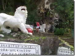 Ian told us all about chattal houses, various types of plants and much more as we headed to our convoy meeting place, the lion at Gun Hill Signal Station. This signal station was restored by the Barbados National Trust and has military memorabilia and great views. The lion was carved out of a single piece of rock in 1868 by a British Army Officer serving on Barbados. The lion has a large globe under it's paw, signifying England's world domination.
The others in the convoy were there already and had seen the lion and were just waiting for us. We had to exchange vehicles (Scooby-Doo for Garfield) because the Scooby was too low on gas. After getting our new vehicle, we took off to join the others.
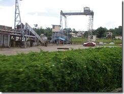 Through the sugar cane fields, past crops of yams and eddoes, past the still-working Andrews Sugar Factory, through mud and ruts, the Land Rover took us all over. Sugar used to be a very important crop here and it was used in another important crop - rum. Now the main industry here is tourism but you can still see lots of sugar growing around the island. It's a rotational crop and they rotate that with the eddoes, yams, pumpkins, cassavas, peanuts and other ground crops.
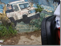 We went past an interesting cliff that has been painted on over the years. Part of the outcroppings suggest a lion, so a lion was painted there and other areas features highlights of Barbados. Here's a painting of our jeep and it's headed towards Bathsheba according to the caption.
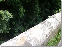 This section of a bridge is over a gully - a collapsed portion of an old cave. When this would happen, rainwater would leak in or be funneled in from the streets and birds would drop seeds in making a new forest or rain forest.
This bridge is particularly interesting. When they made it a couple centuries ago they ran out of building materials so they used what they had on hand - molasses, eggs and eggshells. And it still holds up to this day amazingly well.
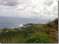 Our next stop was on a high cliff overlooking Bath. It's hard to tell from this picture how high the cliff was but we had several warnings not to get to close to the edge - No Way!
I suspect that this cliff is part of the cliff that Hackleton and his horse leaped off.
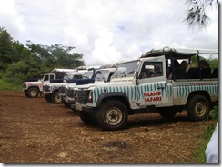 Here are all the Land Rovers lined up ready for our next adventure. They all have the names of cartoon characters and the jungle stripes are different colors.
The sides are plastic and roll down in case of rain, as we'll have a chance to discover a little later. This reminds me of "The Surry With The Fringe On Top" from the musical, Oklahoma:
"...and isinglass windows that'll roll right down, in case there's a change in the weather..."
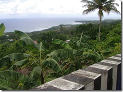 Looking over the banana trees into Bathsheba. This was taken from a solid - I hope! - bridge. To the right is one of many types of palms found on Barbados.
There are also several types of bananas, including plantains. The smaller, green ones are called "fig" bananas and they're cooked green and mashed up and used for their large iron content with pregnant women or people with anemia.
Banana plants are often used here to help prevent soil erosion. Also used to help prevent erosion are gabions. These are rectangular wire baskets filled with small rocks and strategically placed so that water can flow through easily but the soil is held behind. These gabions can often be seen near bridges.
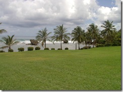 Bathsheba and one of its curiously eroded rocks in the ocean. These are being eroded away from underneath as the tides come and go.
Bathsheba is a beautiful little seaside town. Although it is too rough here to swim here on the Atlantic side, surfers practice and hold competitions here. This surf area is also known as the "Soup Bowl".
Also here is Andromeda Gardens. Although on this trip we didn't stop here, we've been there before. The Gardens were founded over 50 years ago by horticulturist Iris (great name for a horticulturist!) Bannochie. There are 650 plant species there from all over. It's an absolutely beautiful, peaceful 6.5 acres of plant heaven. There are naturally-growing orchids, palms, flowering trees, lily ponds...and animals such as green monkeys, birds, lizards and fish. It's a fantastic way to spend an afternoon.
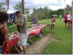 Bathsheba is also a place to pick up lovely beaded jewelry and island crafts. Here Tom is looking for a new band to replace the last one he got here.
The last time I got one was the year that Sue was with us. We all three had them and when mine finally broke Tom fixed it a few times. The last time mine broke and became unfixable I decided not to get any more, at least not for awhile. For me, the bracelet was a reminder of Sue (like Cocomos, in an earlier post) and when that broke, it was like a little part of Sue's memory leaving me.
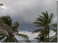 And here come the rain! We didn't roll down the curtains, at least for a while. The rain felt good and cool on my face while riding along.
When we finally put the plastic curtains down they didn't help all that much - rain dripped off the corner of mine and into my molded plastic seat making my human seat soaking wet.
We stopped taking pictures because we didn't want to get the camera wet but we probably have some from a previous year that I can insert into here when we get home.
From Bathsheba we headed north on the Ermy Bourne Highway past Cattlewash (where they used to, well, wash cattle) Most cattle on the island is for dairy only. Most people here eat chicken or fish.
After that, past Barclay Park, a popular area for locals to take a picnic or relax for an afternoon. There used to be a railroad coming up to this point but it stopped service in the 1930's.
Further along was the side of the cliff that they call the Sleeping Giant. When looked at it from the right angle, I could see how it got its name.
At some point, we went through Joe's River Forest. This Tropical Rain Forest consists of 85 acres of woodlands situated in the parish of St. Joseph. With the imposing Hackleton's Cliff on one side and the picturesque Atlantic Ocean on the other, this site is a nature-lover's paradise!
Here we saw fiscus, white woods, cabbage palms, mahogany trees (used for high-end furniture and boats, and the bearded fig trees for which Barbados was named by the Portuguese. We also saw massive termite nests on some of the trees.
We went past the Morgan Lewis Mill, the last complete windmill on the island. Originally there were 530 windmills, used in sugar production but the others have all fallen into disrepair due to changes in the sugar refining process. The Morgan Lewis is kept in good running order now as a historical landmark and it's operated on certain occasions and for school tours.
Then up to Pico Teneriffe. From this point, the next point of land is Teneriffe in the Canary Islands. This is a very interesting part of a cliffy-beach with waves coming up through breaks in the rock as huge water spouts.
The rain let us and we could roll the curtains back up, thank goodness! Without the breeze, it was getting kind of muggy. But the good stuff was finished. We headed across the island to Six Men's Bay, down past the ritzy condos of Port St. Charles, through Speightstown, past Mullen's Bay, and into Holetown for lunch.
We had a nice lunch, similar to the one I described last week in the Cool Runnings post but with the addition of macaroni pie, in a very nice outdoor restaurant attached to the Sandridge Hotel. Unfortunately, this hotel is doomed to be torn down soon, to become the parking lot for the hotel going up next door.
After lunch it started raining a bit again and we were going fast on the ABC highway and the rain hurt. It almost felt like hail but I knew that couldn't be.
Finally, back to the Crane and some dry clothes! What a great day, even with the rain. I like seeing the various sights and hearing the local guides describe his/her island but what I like most is the ride, the jouncing up and down through the fields, over cliffs, into forests, though mud.
Labels: Atlantic, Barbados, Barbados National Trust, Bathsheba, Chalky Mount, chattal house, Cocomos, East Coast, hurricane, Island Safari, Mt. Hillaby, National Trust, potter, rum, sea, Soup Bowl, St. James, St. John, St. John's Parish Church, sugar, surf, Welchman Gully


